Description
....
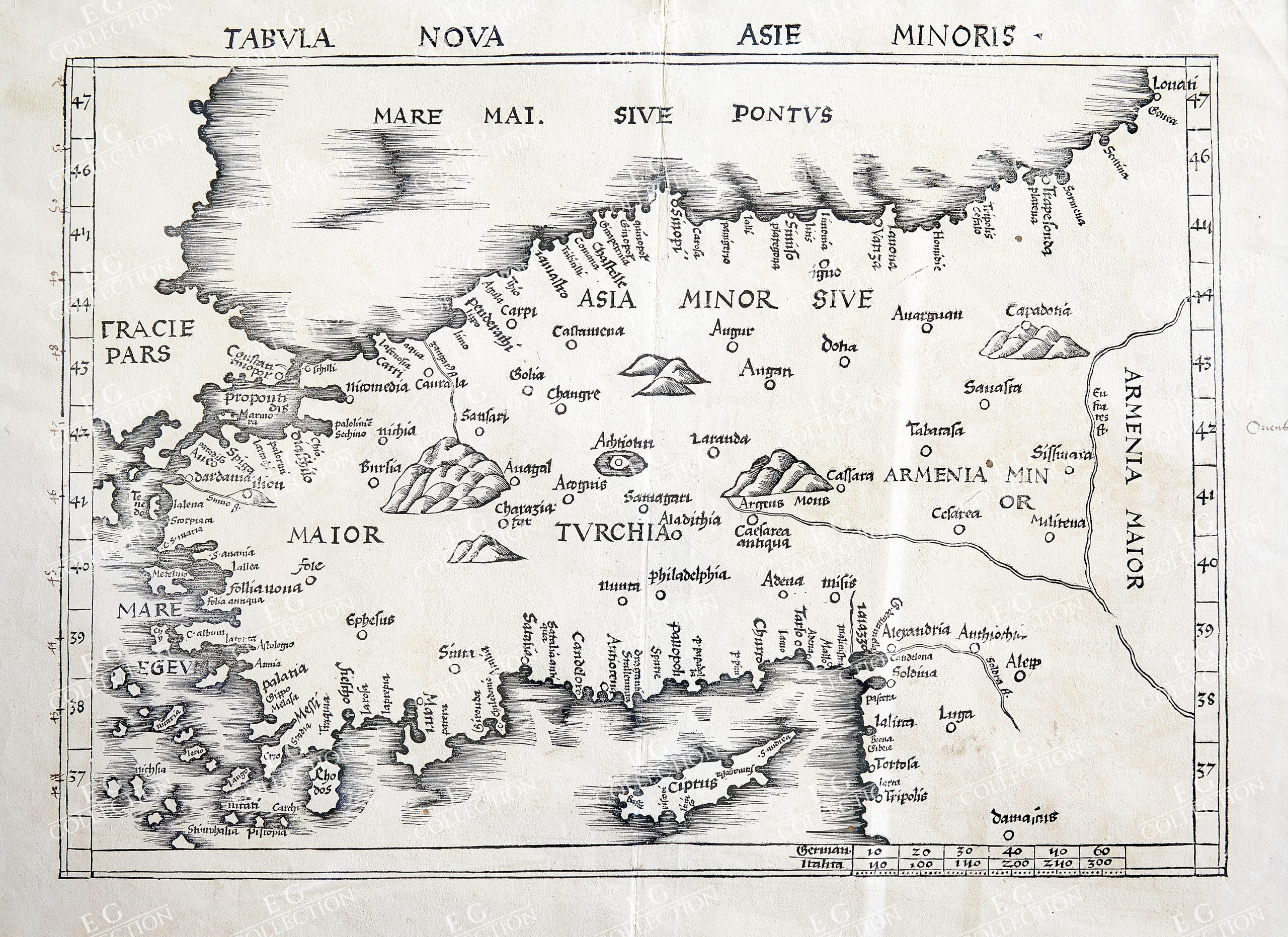
TABULA NOVA ASIE MINORIS
Martin WALDSEEMULLER
Starsbourg, 1513
72 x 59 cm.
1513 Strasbourg edition of Ptolemy’s Geographia
This map appeared in Waldseemüller’s 1513 edition of Ptolemy’s influential Geographia, printed by Waldsemüller’s friend and collaborator Johann Schott. It is likely that Waldseemüller, along with the scholar Matthias Ringmann, started working on the project as early as 1505, but the death of their patron, René II, in 1508 resulted in the closure of their press at St. Dié. Additionally, Ringmann died in 1511. Schott and Waldseemüller finally finished the project in 1513, publishing it with Schott in Strasbourg.
The 1513 edition marked an important shift in the history of cartography because it was the first printing of Ptolemy to incorporate tabulae novellae, or modern maps, in addition to the ancient, Ptolemaic version of geography. The 27 original Ptolemaic maps were accompanied by 20 modern maps. All of its maps were printed from beautifully carved woodblocks made of pear wood. This edition of the Geographia was also the first to be organized so as to separate the ancient from the modern maps, to show how knowledge had changed since Ptolemy’s time fourteen centuries earlier.
$ 2.000,00

 No products in the cart.