Description
....
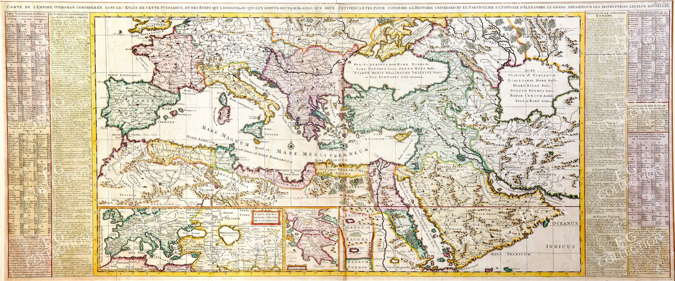
CARTE DE L’EMPIRE OTHOMAN CONSIDEREE DANS LES ETATS DE CETTE PUISSANCE, ET DES ETATS QUI L’AVOISINENT OU QUI LUY SONT TRIBUTAIRES, AINSI QUE DEUX PETITES CARTES POUR CONDUIRE A l’HISTOIRE UNIVERSELLE
CHATELAIN, Henri
Amsterdam, 1714
120 x 51 cm.
Striking example of Chatelain’s map of the Ottoman Empire, depicting the region controlled by Alexander the Great.
One of the few maps of this era to cover the whole of the Ottoman Empire, this large chart extends over the entire Mediterranean and includes Turkish possessions in North Africa. Extending from the Caspian Sea to include Persia and the Arabian Peninsula, the map covers most of southern Europe and northern Africa. Two inset maps including a smaller version of the map and a map of Macedonia and Greece. Great attention has been paid to the geographical features of the region and all the various mountain ranges and bodies of water have been carefully included.
The map is flanked by two large tables which provide a detailed list of the principle towns and states and gives their exact location. There are lengthy historical notes on the Empire of Alexander the Great, as well as a wealth of information on the Roman Empire. The map appeared in Chatelain’s monumental Atlas Historique.
$ 3.000,00
1 in stock

 No products in the cart.