Description
....
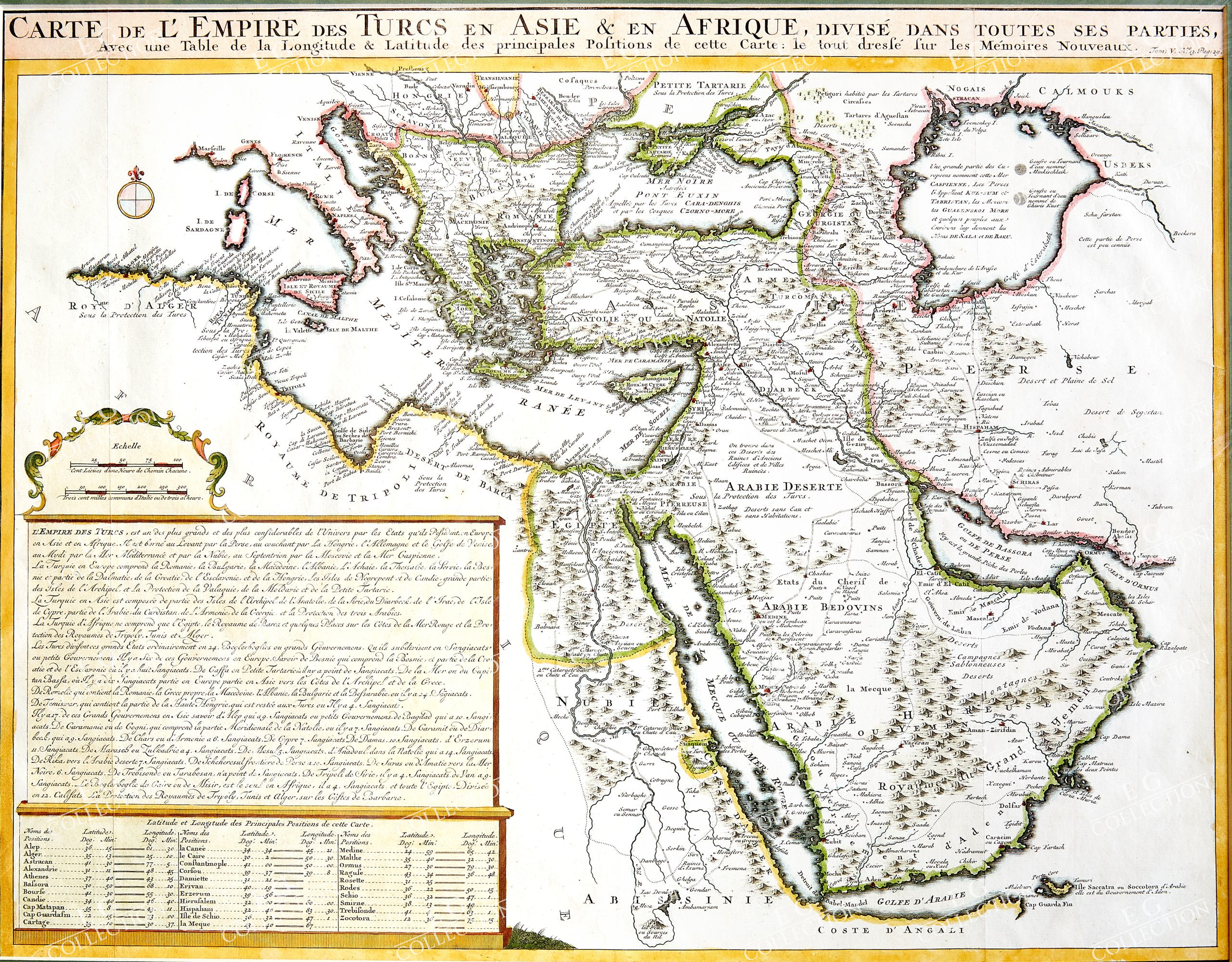
CARTE DE L’EMPIRE DES TURCS EN ASIE & EN AFRIQUE, Divise dans toutess parties…
CHATELAIN, Henri
Paris, 1710
52 x 40.5 cm.
Hand Coloured
Striking map centered on Cyprus and Asia Minor of the region bounded by the Mediterranean in the west and the Caspian and Persia in the east.
The map extends north to the Black Sea and the Ukraine and south to the source of the Nile, the Red Sea and Arabian Gulf.
The map appeared in Chatelain’s monumental Atlas Historique, published in Paris.
$ 1.100,00

 No products in the cart.