Description
....
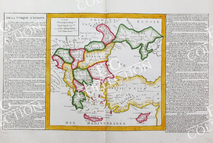
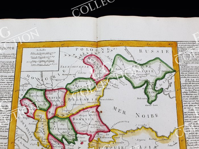
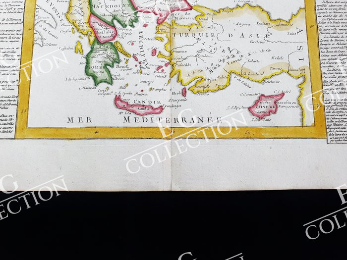
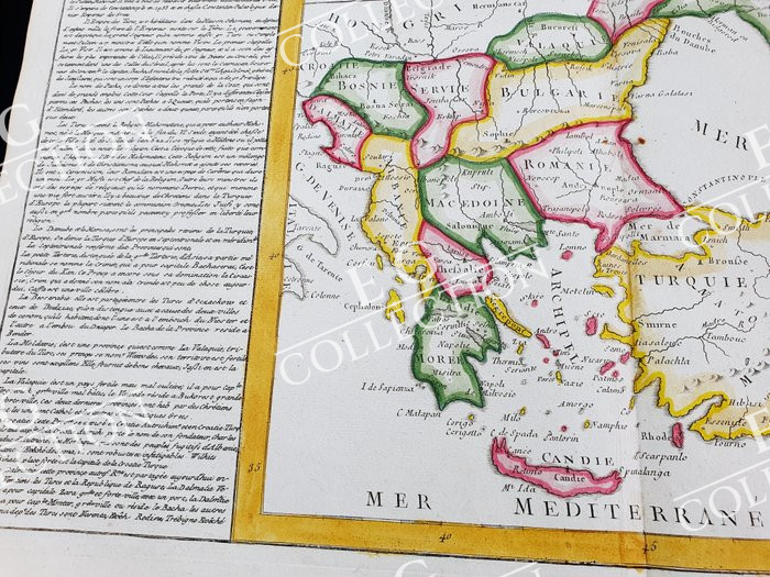

DE LA TURQUIE DE L’EUROPE
Jean Baptiste CLOUET
Paris, 1786
60 x 44 cm.
Later hand colour
This Folio Geographical Map is an original copper engraving from 1786.
This is the edition of CLOUET, published in 1767 in his Atlas, which bears the name of: “Géographie moderni avec une introduction: ouvrage useful a tous ceux qui veulent se perfectionner dans cette science, on y trouve jusqu’aux notions les plus simples dont on a facility……PARIS, 1767”
Beautiful map published in FRANCE, with excellent watercolor painting, wide margins… and geographically well detailed at every point.
This map, as shown in the photo, contains the description on both sides of the geographical area represented.
$ 350,00

 No products in the cart.