DE FER
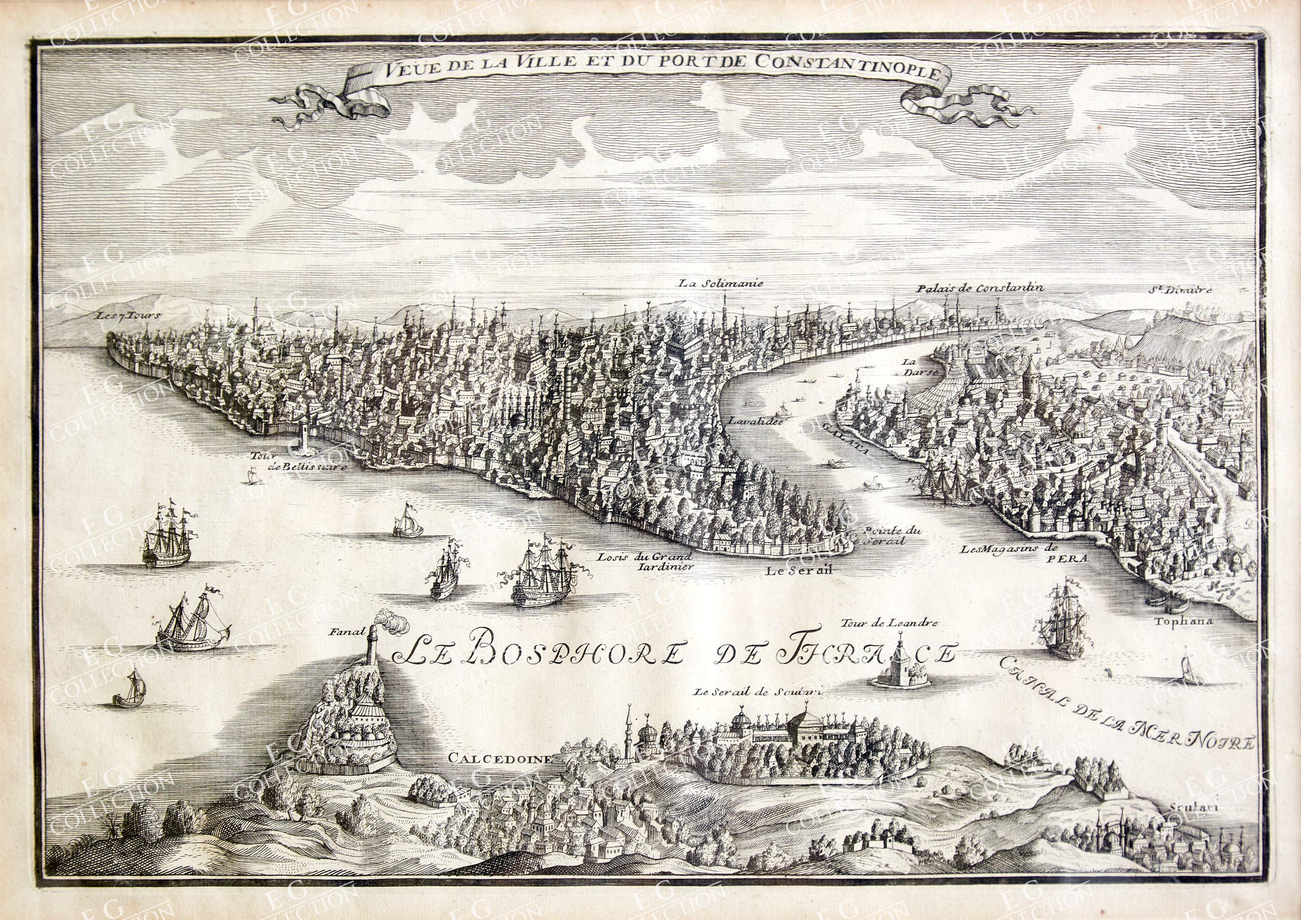
VEUE DE LA VILLE ET DU PORT DE CONSTANTINOPLE
De FER, Nicolas
c.1700, Paris
23.5 x 33.5 cm.
charming, and scarce, bird’s eye perspective view of Constantinople (Istanbul), from De Fer’s L’Atlas Curieux ou Le Monde Représenté dans des Cartes Générales et Particulières du Ciel et de la Térre. The map views the City from Calcedonia and Scutari, looking across the Thracian Bosphorus towards the Golden Horn. The waters are populated by numerus sailing vessels and smaller rowboats. Seraglio point is central, across the water from Pera and the distinctive outline of the Galata Tower. A number of key sites are labelled, including the Süleymaniye Mosque, the Palace of Constantine, the Gardens of Topkapı Palace, the Tower of Leander, and the Tower of Belisarius. Surprisingly, Istanbul’s most famous landmark, the Hagia Sofia, is not listed.
Nicolas de Fer (c.1646-1720) was a leading French cartographer and publisher of maps. The youngest son of the Parisian printer and card publisher Antoine de Fer, he began training as an engraver at the age of twelve. After the death of his father in 1673, de Fer took over his publishing house. He published numerous atlases, and specialised in maps that included new borders and newly conquered territories, as well as maps of cities. In 1690 he became official geographer to the French Dauphin and published his first Atlas of the Coasts of France. Within the next thirty years he acquired additional royal support, becoming official geographer to the Spanish King (formerly the French Duke of Anjou) in 1702, and after the death of the Dauphin in 1711, official geographer to both Spanish and French kings, and in the final year of his life, Géographe ordinaire de sa Majesté Catholique.
$ 1.250,00
1 in stock


 No products in the cart.