CORONELLI
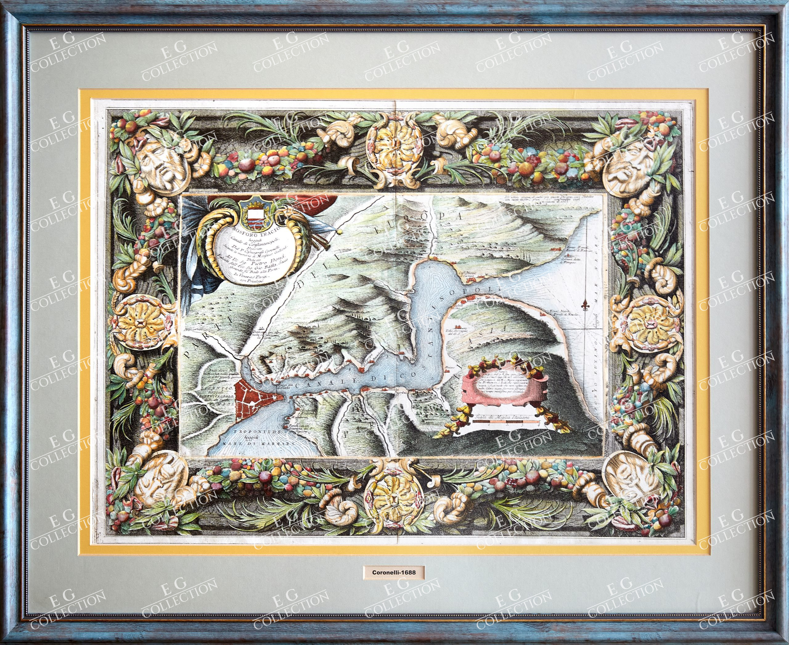
BOSFORO TRACIO, HOGGIDI CANALE DI CONSTANTINOPOLI
Vincenzo Maria CORONELLI
Publication: Corso Geografico Universale
ca. 1692
61 x 45 cm
Magnificent plan of the Bosphorus set within an elaborately engraved border printed from a separate plate. The map was produced during one of the many Venetian-Turkish wars and depicts the strategically important waterway and the city of Constantinople. The map was also issued without the elaborate border, and this state is rarely seen on the market.
Vincenzo Maria Coronelli (1650-1718) was one of the most influential Italian mapmakers and was known especially for his globes and atlases. The son of a tailor, Vincenzo was apprenticed to a xylographer (a wood block engraver) at a young age. At fifteen he became a novice in a Franciscan monastery. At sixteen he published his first book, the first of 140 publications he would write in his lifetime. The order recognized his intellectual ability and saw him educated in Venice and Rome. He earned a doctorate in theology, but also studied astronomy. By the late 1670s, he was working on geography and was commissioned to create a set of globes for the Duke of Parma. These globes were five feet in diameter. The Parma globes led to Coronelli being named theologian to the Duke and receiving a bigger commission, this one from Louis XIV of France. Coronelli moved to Paris for two years to construct the King’s huge globes, which are 12.5 feet in diameter and weigh 2 tons.
The globes for the French King led to a craze for Coronelli’s work and he traveled Europe making globes for the ultra-elite. By 1705, he had returned to Venice. There, he founded the first geographical society, the Accademia Cosmografica degli Argonauti and was named Cosmographer of the Republic of Venice. He died in 1718. (BLR_Barry Lawrence Ruderman)
$ 5.000,00


 No products in the cart.