Description
....
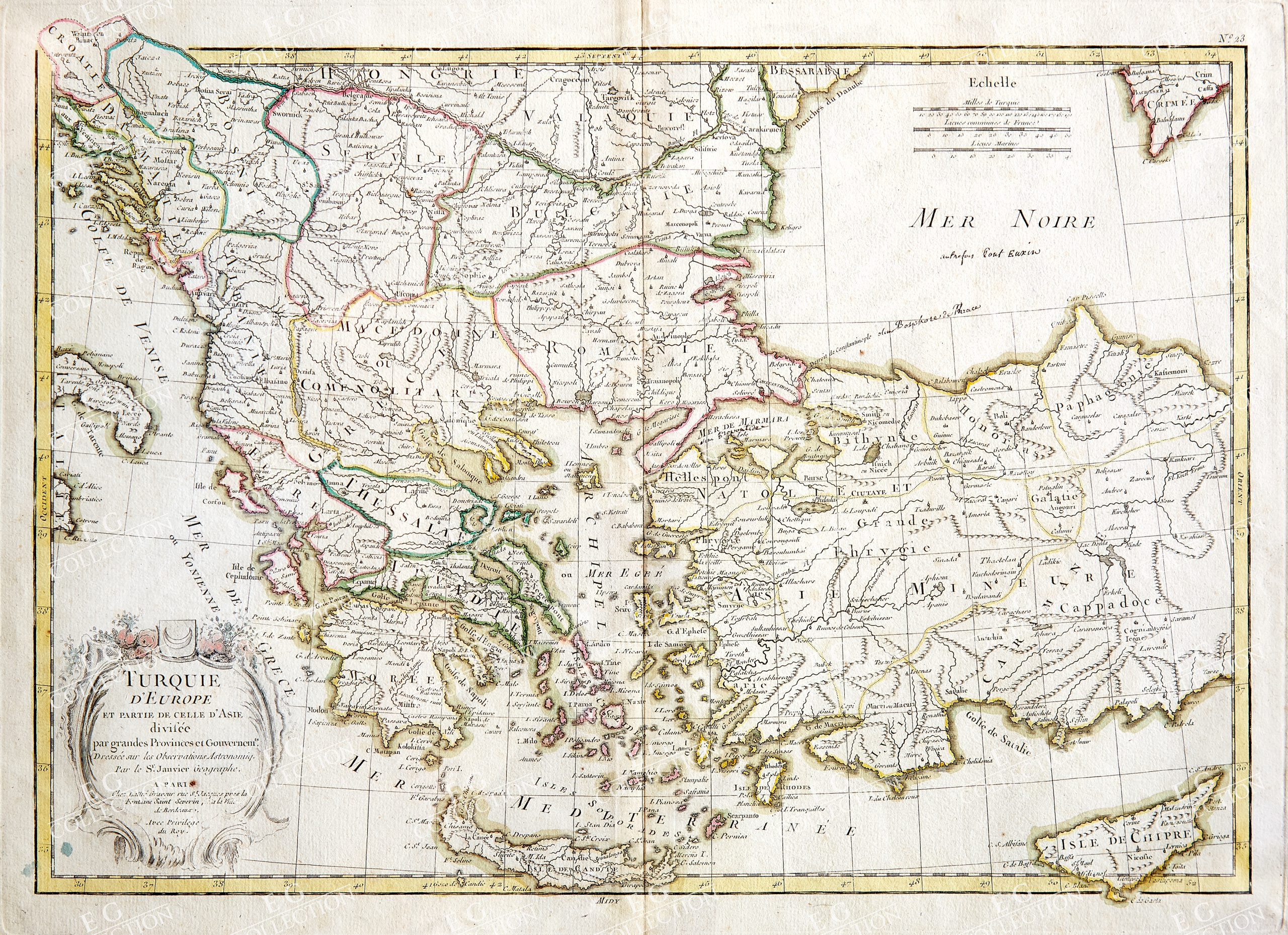
TURQUIE D’EUROPE ET PARTIE DE CELL D’ASIE
DIVISEE PAR GRANDES PROVINCES ET GOUVERNEMTS.
JANVIER, Jean Paris, 1783
32 x 44 cm.
A map presenting the European territories of the Ottoman Empire, covering the land mass from Croatia and the boot of Italy eastward as far as the Crimea, the Black Sea, Cappadocia, and Cyprus. It extends southwards as far as Crete and north to the Hungarian border. Although the Empire was no longer at its peak, it still had control over Albania, Bosnia, Bulgaria, Greece, Macedonia, Romania and Serbia. The boundaries of these territories are drawn in coloured ink, and their names are indicated in French. The map includes the modern day countries of Greece, Turkey, Cyprus, Macedonia, Romania, Bulgaria, Albania, Serbia and Bosnia. The Greek Isles are particularly well represented. Title in a lovely decorative cartouche to lower left corner. Map originally appeared as plate 23 in Jean Lattre’s 1783 issue of the ‘Atlas Moderne’.
Jean or Robert Janvier (fl. 1746-1776) as an 18th century French mapmaker based in Paris. There is some debate over his first name, it either being Jean or Robert as he signed his maps Signor Janvier. He was appointed Geographer Royal in the 18th century. Janvier is best known for his work with Lattré on the 1762 Atlas Moderne.
$ 400,00
1 in stock

 No products in the cart.