Description
....
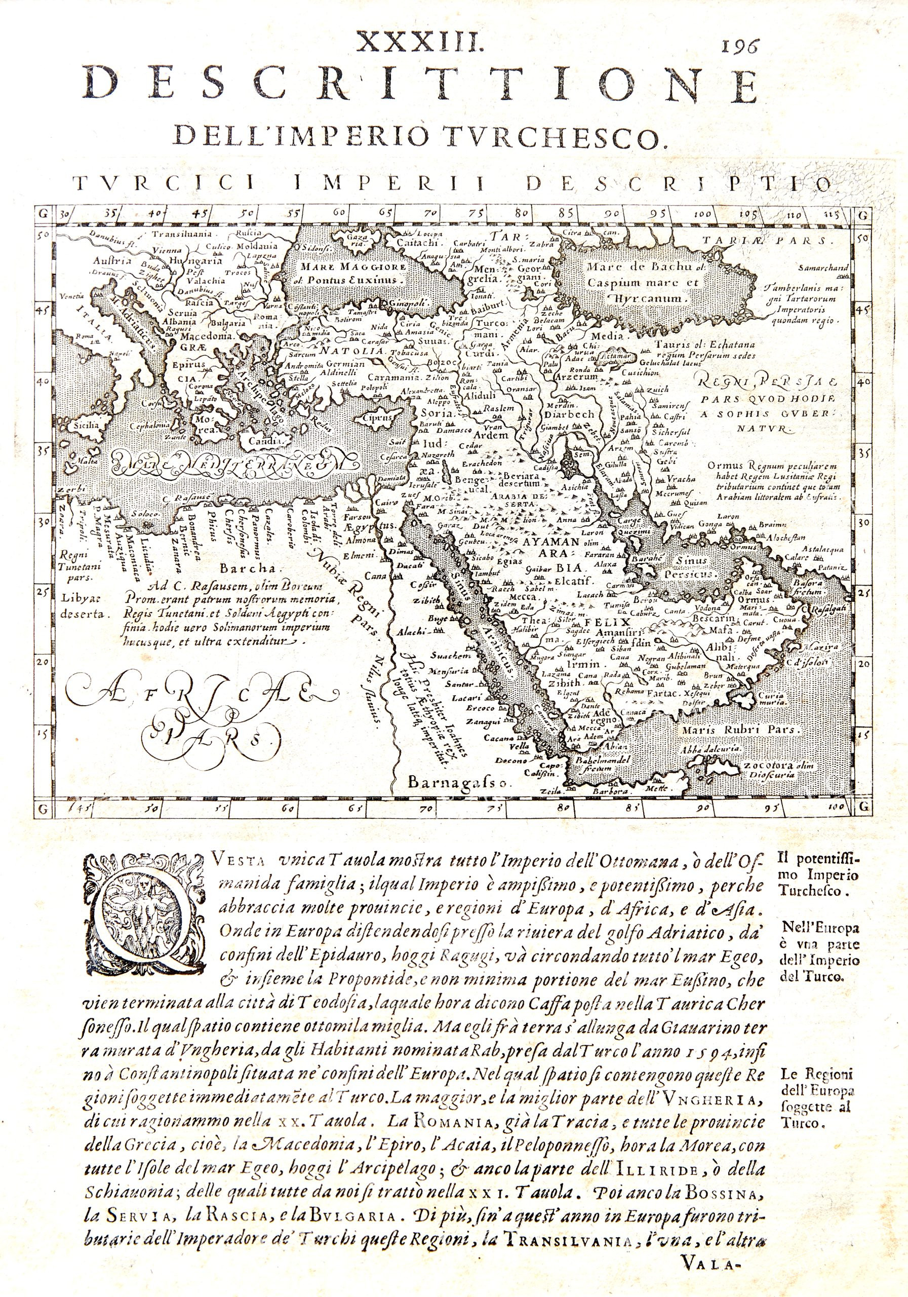
DESCRITTIONE DELL’IMPERIO TURCHESCO
Giovanni Antonio MAGINI
1597,
19 x 28 cm.
Map of the Turkish Empire, centring on the Arabian Peninsula, from the 1597 Latin printing of Giovanni Antonio Magini’s edition of Claudius Ptolemy’s Geographia. The map, ornamented in early colour, charts the extent of the empire from Northern Africa and the eastern end of the Mediterranean across Turkey, the Holy Land, and Arabia. Interestingly the Caspian Sea has been strangely charted, replicating the map produced by Ortelius of the same region.
Giovanni Antonio Magini (1555-1617) was the leading mapmaker of his day working in Italy, author of the first printed atlas devoted to Italy, and also a very important (and rare) wall-map of Italy. Because of the rarity of these works, he is perhaps best known for this edition of Ptolemy, which met both with critical and commercial success, and was reprinted to 1621.
$ 700,00
Out of stock

 No products in the cart.