Description
....
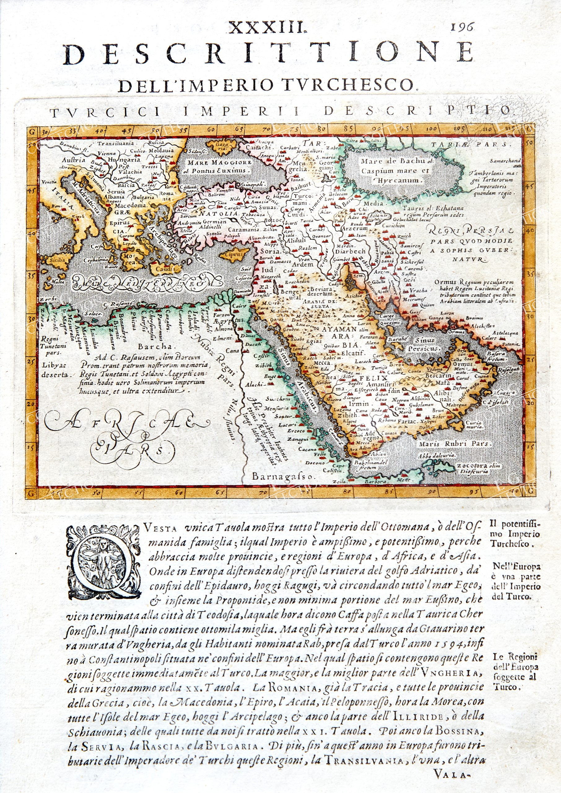
DESCRITTIONE DELL’IMPERIO TURCHESCO
Giovanni Antonio MAGINI
1597,8
19 x 28 cm.
hand colored
Map of the Turkish Empire, centring on the Arabian Peninsula, from the 1597 Latin printing of Giovanni Antonio Magini’s edition of Claudius Ptolemy’s Geographia. The map, ornamented in early colour, charts the extent of the empire from Northern Africa and the eastern end of the Mediterranean across Turkey, the Holy Land, and Arabia. Interestingly the Caspian Sea has been strangely charted, replicating the map produced by Ortelius of the same region.
$ 1.000,00

 No products in the cart.