Description
....
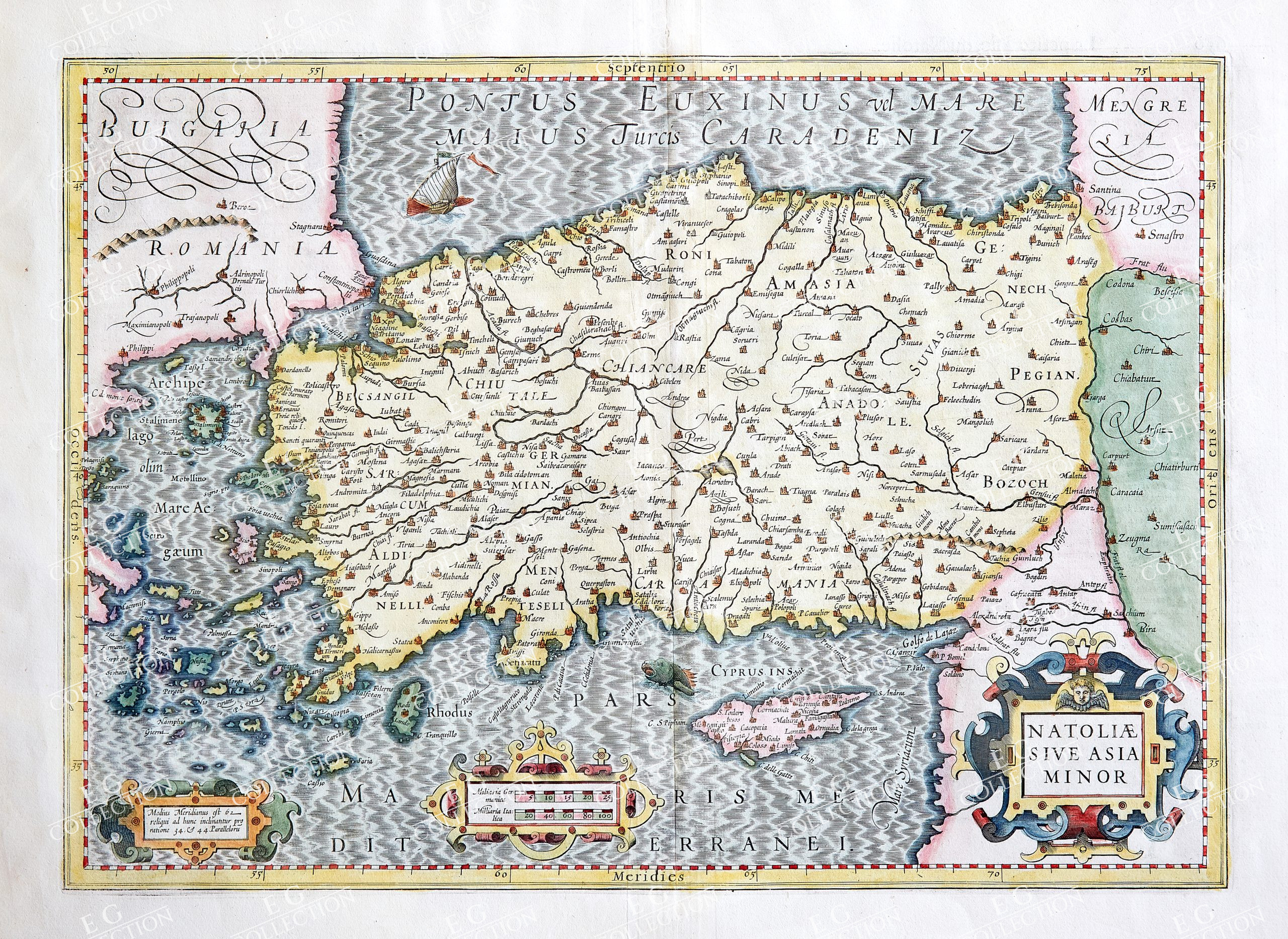
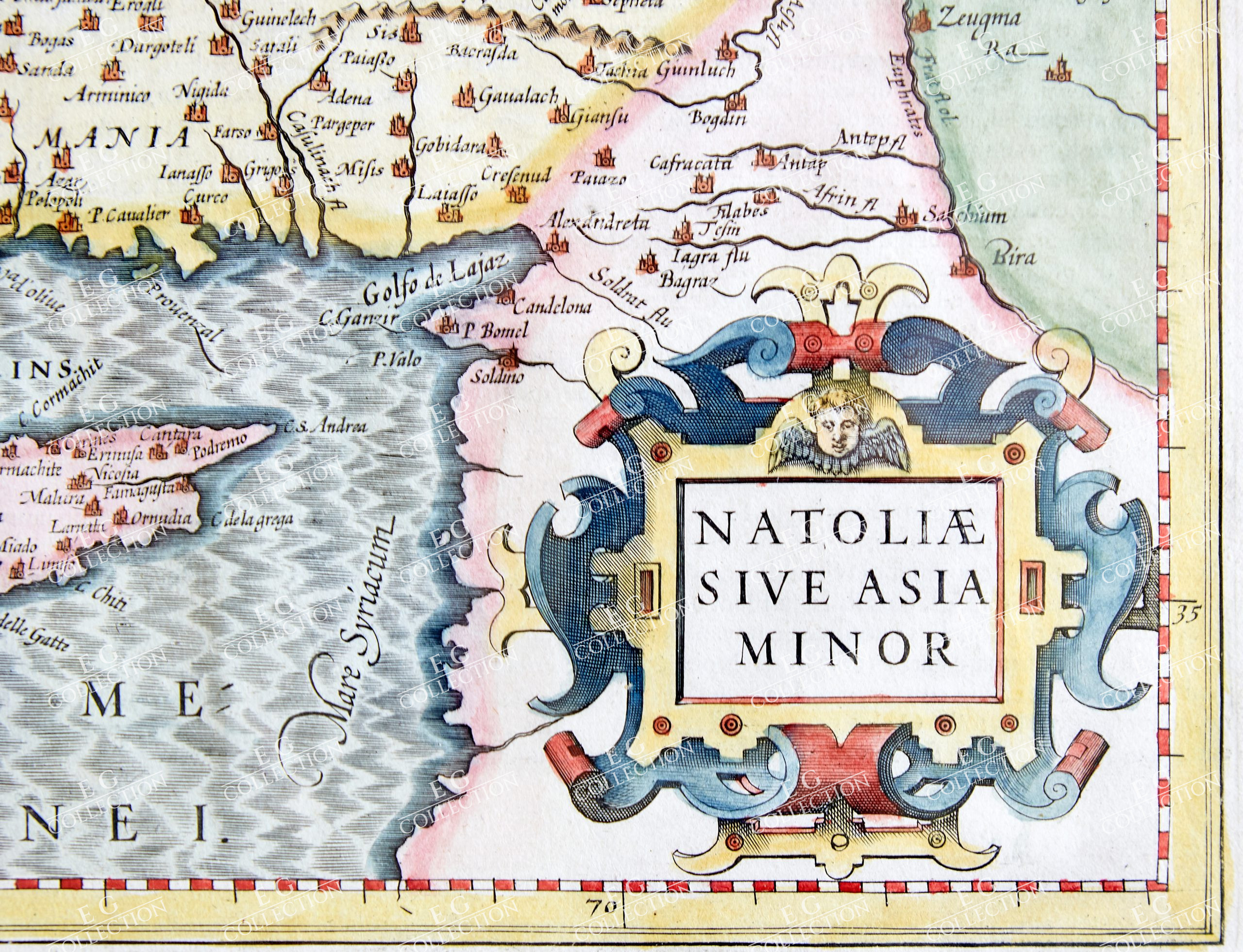
NATOLIAE SIVE ASIA MINOR
Gerard MERCATOR
Amsterdam, c.1623
34,5 x 48 cm.
Fine engraved map with later hand-coloring. Verso text Latin.
This highly decorative map depicts Turkey and Cyprus. Topographical features are shown and major cities, towns, islands, waterways and mountains are located.
The map is further enhanced with a sea monster, sailing ship and three elaborate strapwork cartouches.
Gerard Mercator is considered the “greatest name in geographical science after Ptolemy” and produced the most accurate and current maps of his day. He was the first to choose “Atlas” as the name for a collection of maps. Unlike many of his contemporaries, Mercator’s maps were mostly original work – drawn and engraved by him. This handsome map reflects Mercator’s abilities, in beautiful Renaissance style, as both artist and scientist. (REF: Tooley Maps & Map-Makers).
Gerard Mercator is one of the most famous cartographers of all time. Mercator was born in Flanders and educated at the Catholic University in Leuven. After his graduation in 1532, Mercator worked with Gemma Frisius, a prominent mathematician, and Gaspar a Myrica, a goldsmith and engraver. Together, these men produced globes and scientific instruments, allowing Mercator to hone his skills.
With his wife, Barbara, Mercator had six children: Arnold, Emerentia, Dorothes, Bartholomeus, Rumold, and Catharina. In 1552, Mercator moved to Duisburg from Leuven, where he lived for the rest of his life. In 1564, he was appointed the official cosmographer to the court of Duke Wilhelm of Cleve.
Mercator’s most important contribution was the creation and popularization of a projection which now bears his name. On Mercator projection maps, all parallels and meridians are drawn at right angles to each other, with the distance between the parallels extending towards the poles. This allowed for accurate latitude and longitude calculation and also allowed navigational routes to be drawn using straight lines, a huge advantage for sailors as this allowed them to plot courses without constant recourse to adjusting compass readings.
Mercator’s other enduring contribution to cartography is the term “atlas”, which was first used to describe his collection of maps gathered in one volume. The Mercator atlas was published in 1595, a year after Mercator’s death, thanks to the work of his sons, particularly Rumold, and his grandsons.
$ 1.050,00

 No products in the cart.