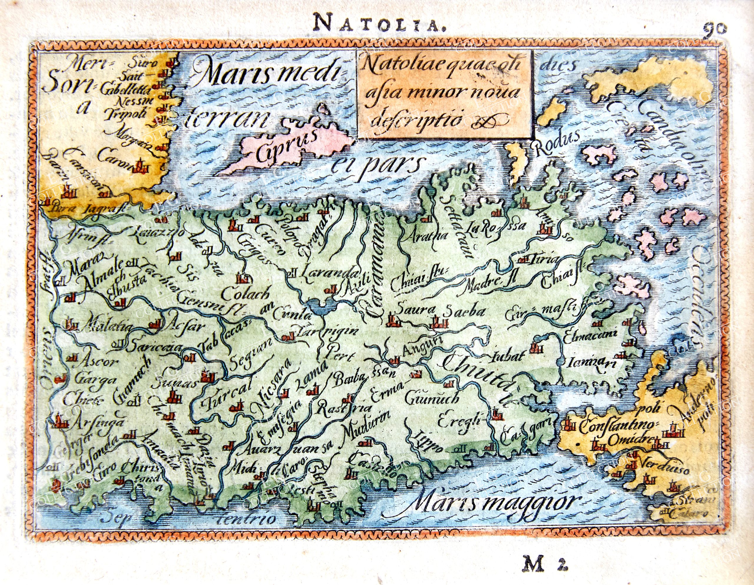
ORTELIUS
NATOLIAE QUAE OLIM ASIA MINOT NOVA DESCRIPTIO
ORTELIUS, Abraham (1527-1598)
Antwerp, 1593
7.5 x 10.7 cm.
From the pocket atlas “Theatro del Mondo”.
Abraham Ortelius, who came from an Augsburg family, was born in Antwerpen, which was Spanish at that time and the most famous trading center of Europe. He remained there all his life. After a good education in arts, languages, mathematics and sciences he joined the “Lukasgilde of Antwerpen” as a map-drawer in 1547. 1554 he took over an antique shop and colored, edited and sold maps and books. In this year – at the bookfair in Frankfurt – he made the acquaintance of a famous man of his time: Gerhard Mercator (1512- 1594); who gave him the idea of edging and producing maps by himself. They became friends a lifelong. Ortelius first own work is a large map of the world in 8 sheets, which appeared 1564 in Antwerpen, followed by a map of 2 sheets of Egypte (1565) and another of Asia (1567)His really big chance came through a friend, J. Rademaker, who was acquainted to a very successful merchant – Aegidius Hooftman. Times were hard, everywhere campains and unrests. Hooftmann , as a trader, was very troubled by these, so he constantly investigated the safest routes through the country. In his office he stored a lot of maps and geographical descriptions in different sizes of sheets and rolls, which were difficult to handle. At this time there were already collections of maps like these of the Italian Lafreri, bur they contained only maps of different sizes and also often maps of one country by different mapmakers.So Ortelius was the first who had the idea to produce a handy collection of only one size and by only one mapmaker – for only one country. The idea of the first atlas was born. Mercator, who also started in 1569 to draw an atlas of the world, persuaded his friend to publish his Theatrum Orbis Terrarum For 10 years Ortelius travelled, collected, corresponded and negotiated until he finally was able to start the edition at the best printers – Plantijn in Amsterdam. Besides difficulties in printing he had to deal with political and religious conditions. This was the time of Inquistion. All printings, also maps were censored. Certain coats of arms and heraldic figures were suspicious and not allowed to print, biblical scenes were welcome..
The first edition of Theatrum consisted of 70 maps on 53 sheets, which were engraved in copper by Frans Hogenberg. It appeared in 1570. Already in the same year the second edition was published, containing now 91 instead of 87 records of carthographers. Ortelius showed every name of his authors if possible. This “Catalogus Autorum” showed also the names of mapmakers, who were known to him. In later editions this catalogue grew more and more voluminous. So it consisted in 1595 of 155 maps Besidethe new editions about 750 Additamenta were issued – additions to atlas editions and also about 600 Parergons, which consisted of reconstructed maps, originating from antiquity. We know his editions in different languages; Latin 1570 – 1612, Dutch 1571, 1598, German 1572 – 1602, French 1572 – 1598, Spanish 1588 – 1612, English 1606, Italian 1608 and 1612.
One posthumous edition, still prepared for printing by himself, appeared in 1598.The next edition which appeared in 1601 had started still at his lifetime, but can’t be regarded as his own work. This edition contained 121 maps and 40 maps in the Parergon”.The number of the names of carthographers had increased to 183. Since 1570 altogether 41 editions appeared, including those in foreign languages.In 1576 and later a pocket-sized edition of the “Theatrum” was published, which got different names: Epitome, Enchiridon, Spieghel, Le Miroir etc. They appeared until 1724.In the year 1575 Philipp II of Spain appointed Abraham Ortelius to the rank of “His Majesties Royal Cartographer”.Ortelius’ work includes also a description of his travels all over the Netherlands, Belgie, France ,
England and Germany , which appeared in 1575, being a source of the history of these countries. We know, that he was in command of all these languages, also of Latin, Italian and some Spanish, a fact, that helped him with the text on the backside of the maps – together with many authors he worked with.
“Theatrum Orbis Terrarum” – the first atlas ever to appear – is regarded as a turning-point in the history of carthography – the time of the old famous “Mappa Mundi” is finished now, being cut now into single maps. The atlas “Theatrum” showed clearly the new way: many reliable single maps, performing together a coherent geographical picture of the world. The “ Theatrum “ contained also an aspect of spectacular importance: It showed America, clearly being an independent continent: there was no connection between the northern part of it with Asia.
$ 1.500,00
1 in stock


 No products in the cart.