ORTELIUSSOLD
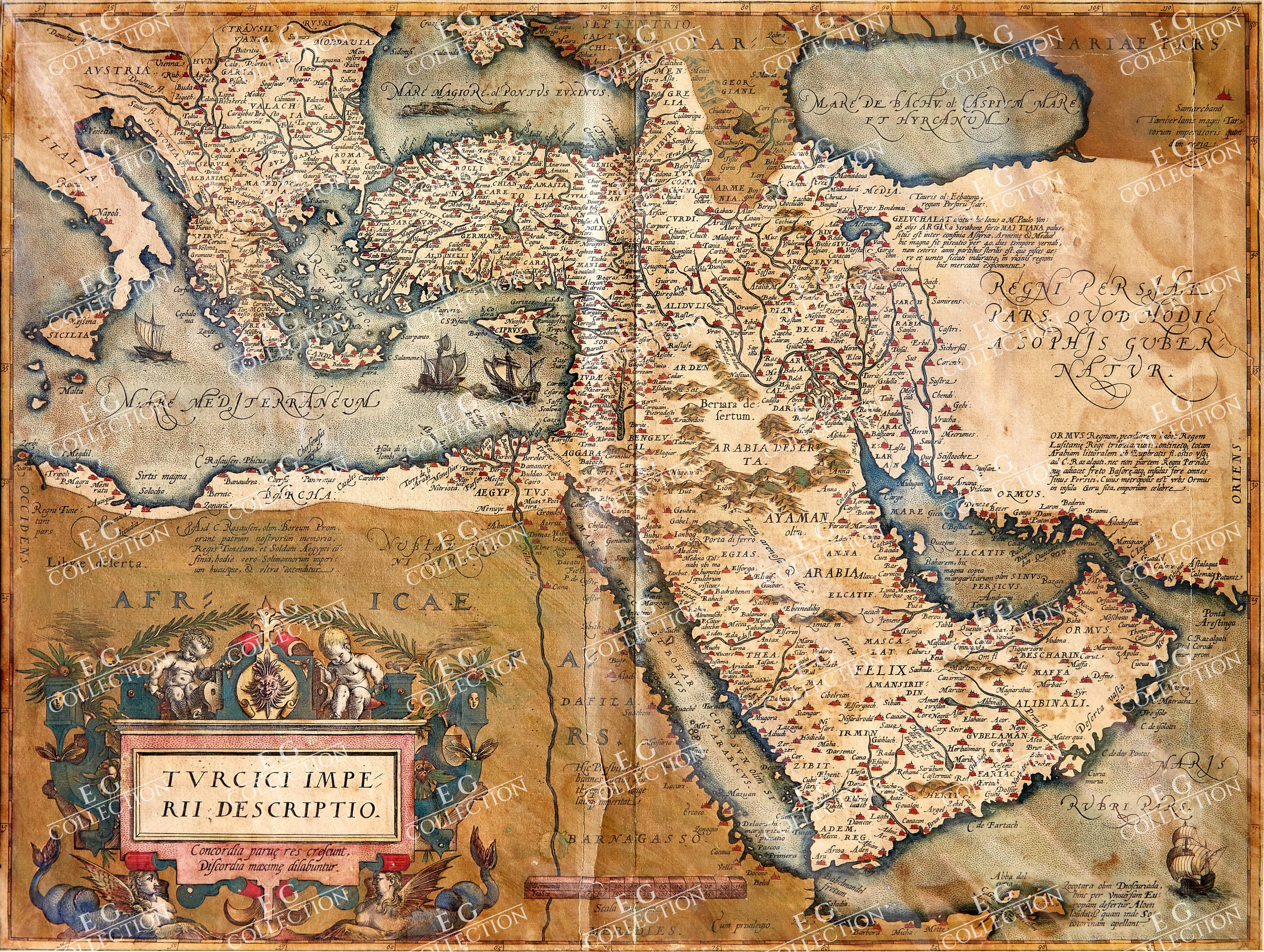
TURCICI IMPERII DESCRIPTIO. . .
ORTELIUS, Abraham
Antwerp, 1595 circa.
48 x 38 cm., Hand Colored
Nice example of Ortelius’ Turkish Empire, embracing the Middle East, Turkey and the Eastern Mediterranean from Sicily to Cyprus.
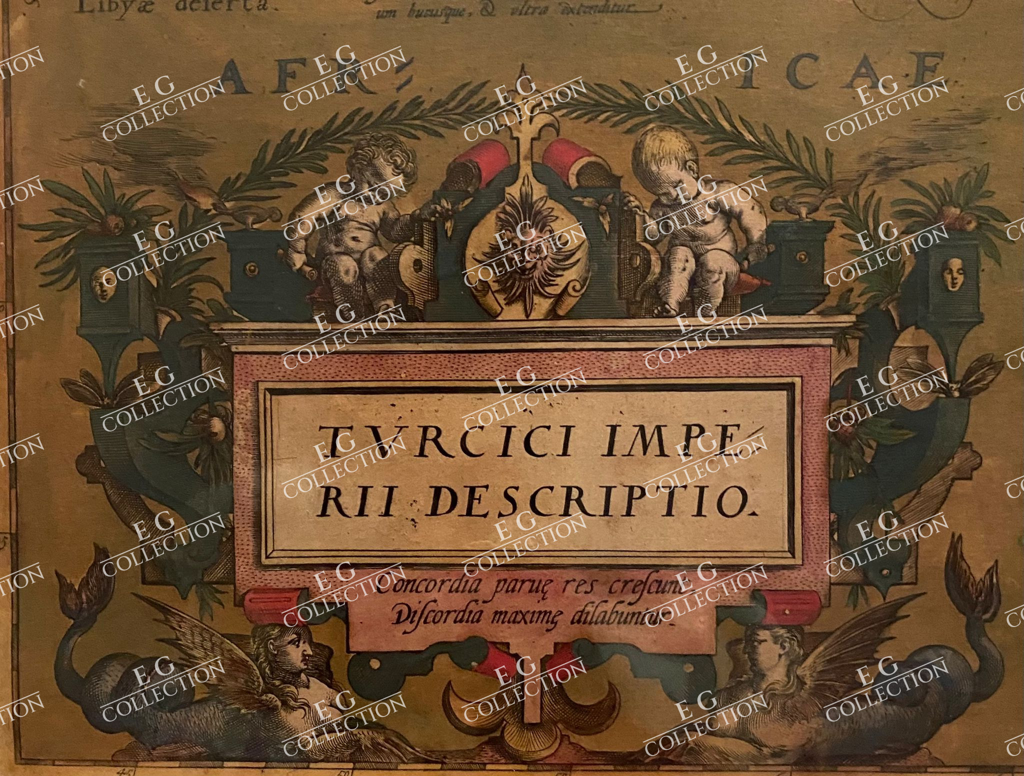
The map is based upon Giacomo Gastaldi’s wall map of Asia of 1561. It includes an ornate cartouche in the lower left corner decorated with lattice work, lanterns, and two female centaurs. The inscription below the title reads, “Through unity small things grow, through discord they fall asunder.” This was likely a reference to the power of the diverse Ottoman Empire in the later sixteenth century, as the Empire was reaching its zenith at precisely the time this map was published. Other decorations include four sailing vessels and a sea monster in the Black Sea.
There are several other descriptions of note on the map. One paragraph, near Lake Actamar just below the Caspian Sea, describes the various names for the lake throughout history. It also mentions that the dried fish caught there are sold around the region. Resources and goods are important to Ortelius with regard to the Ottoman Empire, as he also mentions the famous market town of Ormus, capital of a tributary kingdom that answers to Lusitania. Near Jemen he mentions that the local incense is distributed around the world, while the aloe of Zocotara is also singled out for praise. Finally, of note because it was representative of the popularity of the myth, near the Nile is the inscription, “Here rules Prester John far and wide, king of all of Æthiopia.”
Ortelius’ map of the Turkish Empire shows the might of this large political entity. Under the reign of Sultan Selim I (r. 1512-1520), the empire trebled in size. Suleiman I, also known as Suleiman the Magnificent, was the tenth and longest ruling Sultan, maintaining power from 1520 until his death in 1566. Under his policies, the Empire extended further to conquer Belgrade, Rhodes, and much of Hungary and Iraq. Suleiman I was a well-known political figure of the sixteenth century and his power radiates from the territory highlighted on this map. The Ottoman Empire would continue to expand and flourish in the seventeenth century, a constant foil to the other European empires.
The influence of this and other Ortelius maps stems from the popularity and dominance of his atlas in the European market. In 1570, Ortelius published the first modern atlas; that is, a set of uniform maps with supporting text gathered in book form. Previously, there were other bound map collections, specifically the Italian Lafreri atlases, but these were sets of maps-not necessarily uniform-selected and bound together on demand.
Theatrum Orbis Terrarum, Ortelius’ atlas, outperformed competing atlases from other cartographic luminaries like the Mercator family. Between 1570 and 1612, 31 editions of the atlas were published in seven languages.
Ortelius included the first edition of this map in the first edition of his atlas in 1570. The first edition plate was used until 1579, when a second plate with a different cartouche was substituted for the first version.
The cartographic features of the two are the same.
Abraham Ortelius Biography
Abraham Ortelius is perhaps the best known and most frequently collected of all sixteenth-century mapmakers. Ortelius started his career as a map colorist. In 1547 he entered the Antwerp guild of St Luke as afsetter van Karten. His early career was as a business man, and most of his journeys before 1560, were for commercial purposes. In 1560, while traveling with Gerard Mercator to Trier, Lorraine, and Poitiers, he seems to have been attracted, largely by Mercator’s influence, towards a career as a scientific geographer. From that point forward, he devoted himself to the compilation of his Theatrum Orbis Terrarum (Theatre of the World), which would become the first modern atlas.
In 1564 he completed his “mappemonde”, an eight-sheet map of the world. The only extant copy of this great map is in the library of the University of Basel. Ortelius also published a map of Egypt in 1565, a plan of Brittenburg Castle on the coast of the Netherlands, and a map of Asia, prior to 1570.
On May 20, 1570, Ortelius’ Theatrum Orbis Terrarum first appeared in an edition of 70 maps. By the time of his death in 1598, a total of 25 editions were published including editions in Latin, Italian, German, French, and Dutch. Later editions would also be issued in Spanish and English by Ortelius’ successors, Vrients and Plantin, the former adding a number of maps to the atlas, the final edition of which was issued in 1612. Most of the maps in Ortelius’ Theatrum were drawn from the works of a number of other mapmakers from around the world; a list of 87 authors is given by Ortelius himself
In 1573, Ortelius published seventeen supplementary maps under the title of Additamentum Theatri Orbis Terrarum. In 1575 he was appointed geographer to the king of Spain, Philip II, on the recommendation of Arias Montanus, who vouched for his orthodoxy (his family, as early as 1535, had fallen under suspicion of Protestantism). In 1578 he laid the basis of a critical treatment of ancient geography with his Synonymia geographica (issued by the Plantin press at Antwerp and republished as Thesaurus geographicus in 1596). In 1584 he issued his Nomenclator Ptolemaicus, a Parergon (a series of maps illustrating ancient history, sacred and secular). Late in life, he also aided Welser in his edition of the Peutinger Table (1598).
$ 1.200,00
Out of stock


 No products in the cart.