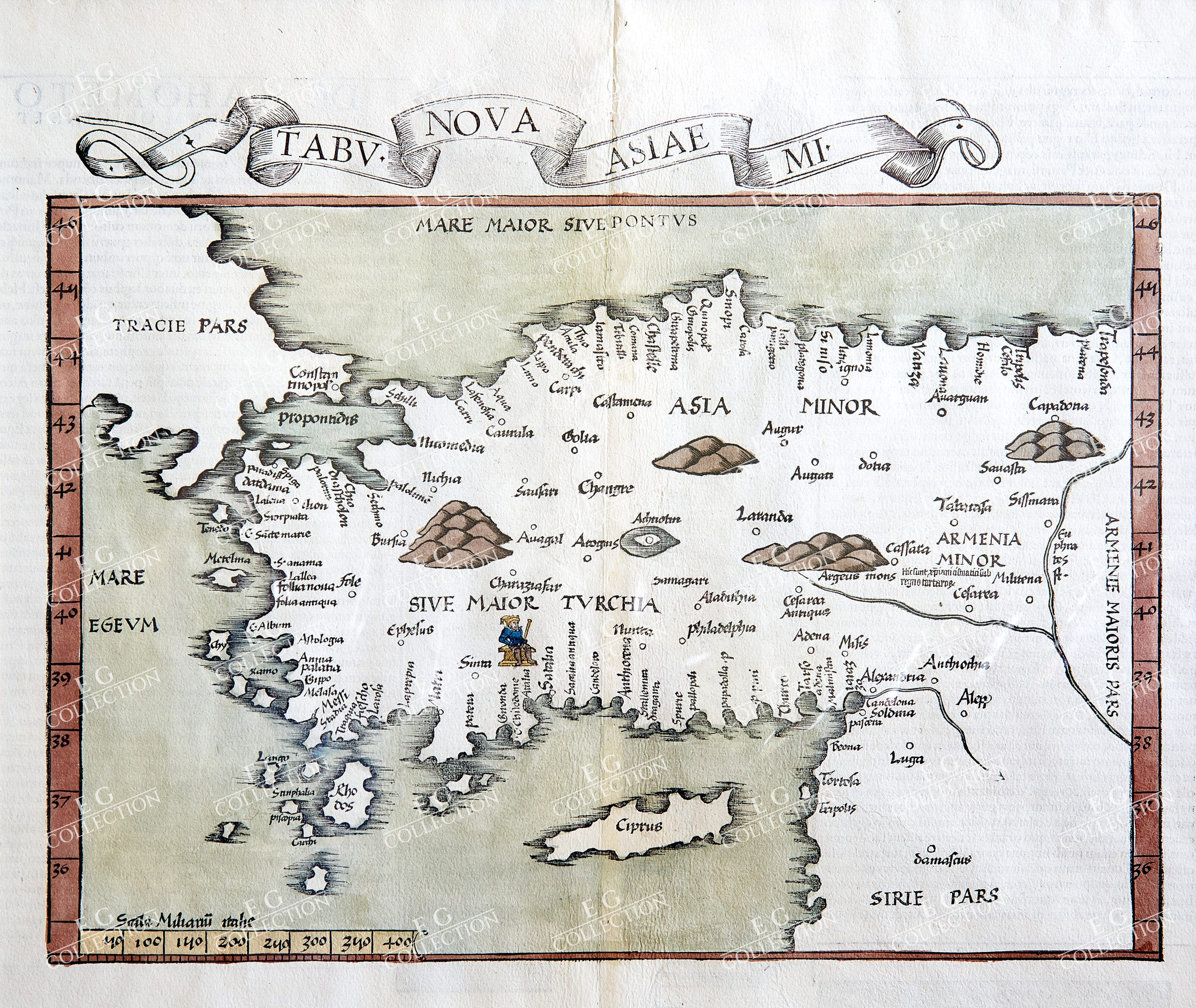
PTOLEMY/WALDSEEMULLER
TABU NOVA ASIAE MI.
WALDSEEMULLER, Martin (1470-1521)
Strasbourg, c.1521
26.2 x 47.7 cm.
From the atlas ‘Claudii Ptolemei … Opus Geographie’ printed by Johannes Schotus.
Claudius Ptolemy (87-150) was an Egyptian astronomer and geographer living and studying in Alexandria. Alexandria was not only the home of the greatest library of any period, but was also one of the most important trade centres between west and east – here Ptolemy could not only study ancient authorities, but could also consult contemporary travellers and merchants. From this wealth of accumulated knowledge, Ptolemy composed his “Geographia”, a work of considerable genius, which “dominated the whole of the Christian and Moslem world for 1,500 years” (Tooley).
It was Ptolemy who introduced the concept of latitude and longitude to form a grid to cover the whole world, so that it would be possible to plot the position of principal land-marks on the map by observations, and then fill in other information from other sources, including the notes and Itinerary of Marinus of Tyre, perhaps the most accurate source available.
Unfortunately Ptolemy was hampered by the paucity of observations – as a result he exaggerated the length of the Mediterranean by over 20 degrees -and by lack of information which was often circumvented by invention. Despite these errors, which persisted for nearly 1,500 years, the work was of fundamental importance at a time when little was being done in the way of modern mapping. As a result of this work, which was so far in advance of anything before or anything produced in the next 1,500 years, Ptolemy has earned the reputation and accolade, “the father of geography” (Tooley).
In 1477, the first printed edition of Ptolemy’s “Geographia” with maps was issued in Bologna. Testimony to the influence of Ptolemy and popularity of his maps is given by the number of editions of the Ptolemaic atlas – even as late as 1840 “classical” atlases were being published based almost solely on his detail of the Ancient World.
Although the cartographic content of the Ptolemaic atlases and maps was standard, certain editions are worthy of comment:
• 1477 the first edition with maps. Copper engravings.
• 1482- Ulm Ptolemy. The first edition printed north of the Alps, with four modern
maps added. Printed from woodblocks.
• 1513- Published by Martin Waldseemuller, incorporating 20 new maps, including
the second map to focus on the discoveries of the New World. Woodblocks.
• 1522- Illustrated with woodblocks cut by Laurent Fries, careful reductions of
Waldseemuller’s maps.
• 1540- Sebastian Munster’s issue of Ptolemy’s maps; subsequently re-issued in
a variety of books of classical geography -attractive woodblocks.
• 1548- The first Italian text edition, the first miniature edition in copperplate of
Ptolemy’s Geography, including several new maps by Gastaldi.
• 1561- Gastaldi’s maps re-issued, in a slightly larger format, by Ruscelli and
Valgrisi in Venice.
• 1578- the first issue of Mercator’s version of Ptolemy’s maps – intended as a
companion to his Atlas of the Modern World. Numerous re-issues. For the 1698 edition, the plates were re-worked, substituting a new cartouche within the map, containing a second title.
$ 2.150,00
1 in stock


 No products in the cart.