Description
....
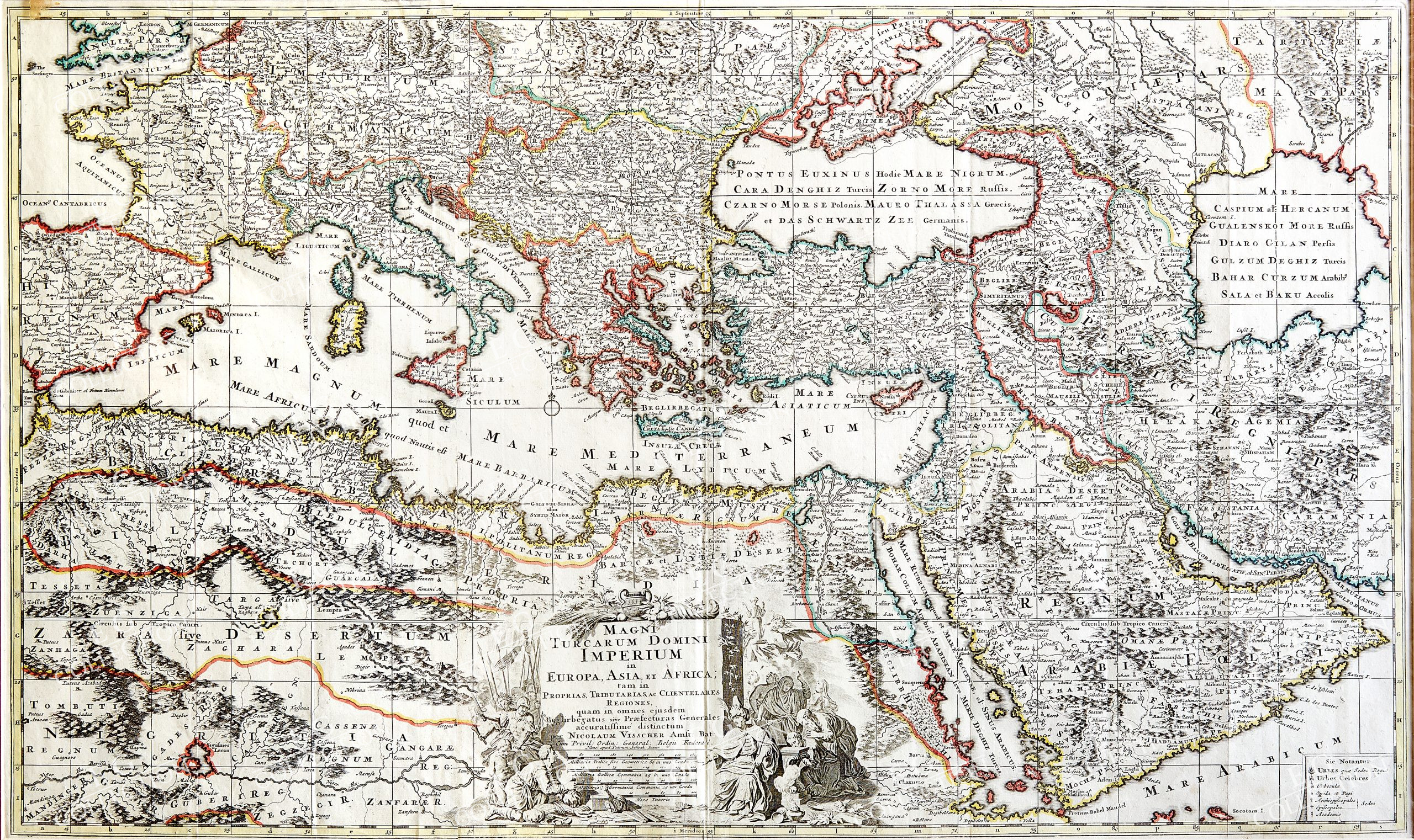
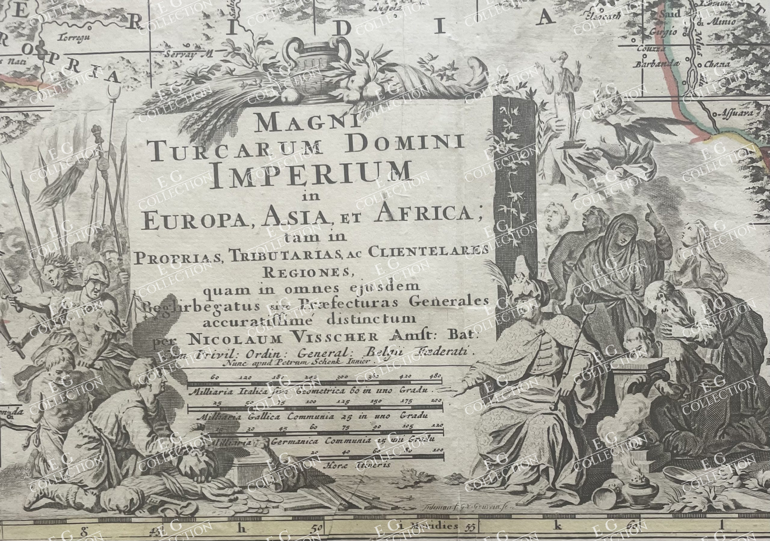
MAGNI TURCARUM DOMINI IMPERIUM
VISSCHER I, Nicolaes
Amsterdam, 1679
53.5 x 89 cm.
This large-scale map shows the extent of the Turkish Empire in Europe, Asia and Africa. The map is densely engraved with details of cities, political boundaries, rivers, and mountains. The Caspian Sea is depicted in an almost square shape. The map is adorned with a handsome allegorical cartouche. Printed on two sheets, joined as issued.
$ 2.250,00
Out of stock

 No products in the cart.