Açıklama
....


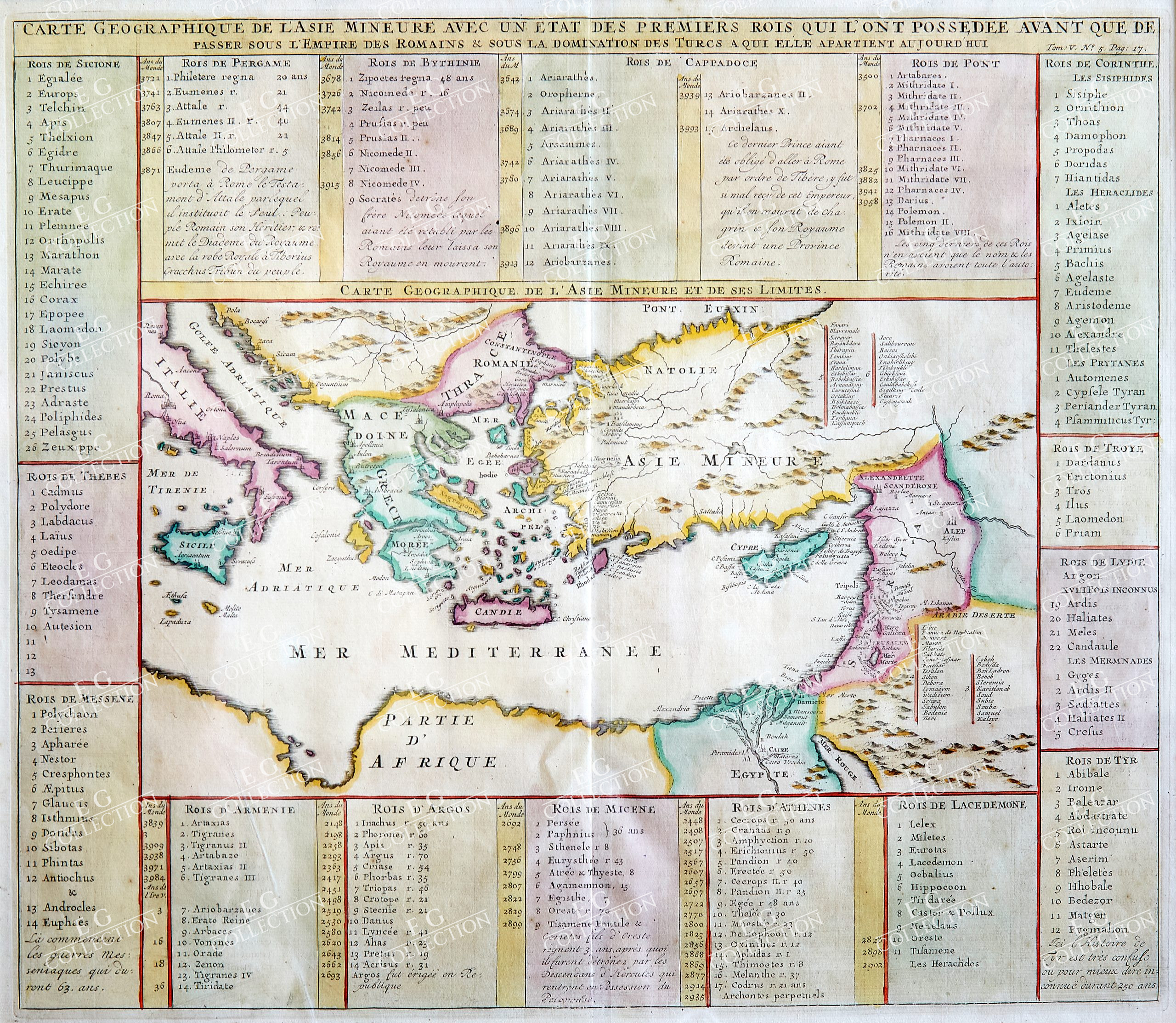
CARTE GEOGRAPHIQUE DE L’ASIE MINEURE AVEC UN ETAT DES PREMIERS ROIS…
CHATELAIN, Henti Abraham (1684-1743) Amsterdam, c1720
37.5 x 43 cm.
Detailed map of the Mediterranean Region, from Chatelain’s monumental Atlas Historique.
Henri Chatelain Biography
Henri Abraham Chatelain (1684-1743) was a Huguenot pastor of Parisian origins. Chatelain proved a successful businessman, creating lucrative networks in London, The Hague, and then Amsterdam. He is most well known for the Atlas Historique, published in seven volumes between 1705 and 1720. This encyclopedic work was devoted to the history and genealogy of the continents, discussing such topics as geography, cosmography, topography, heraldry, and ethnography. Published thanks to a partnership between Henri, his father, Zacharie, and his younger brother, also Zacharie, the text was contributed to by Nicolas Gueudeville, a French geographer. The maps were by Henri, largely after the work of Guillaume Delisle, and they offered the general reader a window into the emerging world of the eighteenth century.
Henri Abraham Chatelain (1684 – 1743) was a Huguenot pastor of Parisian origins. He lived consecutively in Paris, St. Martins, London (c. 1710), The Hague (c. 1721) and Amsterdam (c. 1728). He is best known as a Dutch cartographer and more specifically for his cartographic contribution in the seminal seven volume Atlas Historique, published in Amsterdam between 1705 and 1720. Innovative for its time, the Atlas Historique combined fine engraving and artwork with scholarly studies of geography, history, ethnology, heraldry, and cosmography. Some scholarship suggests that the Atlas Historique was not exclusively compiled by Henri Chatelain, as is commonly believed, but rather was a family enterprise involving Henri, his father Zacharie and his brother, also Zacharie.
Map of the Mediterranean. Ornamented with numerous vignettes representing some of the Dutch settlements in the East Indies. Exhaustive information about the settlements is given in lengthy tables. The maps were accompanied by information pertaining to cosmography, geography, history, chronology, genealogy, topography, heraldry, and costume of the world.
Greek culture, the Roman Empire and Christianity have to leave their mark to those days. In ancient times, at the time of Augustus, the Roman Empire united all of southern Europe coutries together with the other coasts of the Mediterranean in one great empire. In the Roman Empire, the new religion of Christianity spreaded quickly. In the early Middle Ages, the Paderborn epic made the ruler of the Franconian Empire, Charlemagne, the “father of Europe”. The Middle Ages war under the conflicts between the new Roman emperor in the west and the Byzantine emperor in Constantinople in the east, on each of their own spheres of influence the last deepened division in a western and eastern Europe. Since the 15th century, European nations (particularly Spain, Portugal, Russia, the Netherlands, France and the United Kingdom of Great Britain and Northern Ireland) built colonial empires with large possessions on all other continents. Europe is the continent, the other continent is the greatest access, for example through Christian missionary work, colonies, slave trade, exchange of goods and culture. In the 18th century, the Enlightenment movement set new accents and rights tolerance, respect for human dignity, equality and freedom. In France, the French Revolution brought the bourgeoisie to power in 1789. In the early 19th century, half of Europe was heading towards the will of the well-known emperor Napoleon, who belonged to power after the revolution, until he experienced a fiasco in Russia in 1812. The conservative victorious powers, who distinguished between pre-revolutionary relations in the context of the Vienna Congresses, succeeded only moderately. Industrialization began in the possession of Europe in the 18th century and in the development of everyday life for large sections of the population.
$ 1.100,00
1 adet stokta


 Sepetinizde ürün bulunmuyor.